
Notation for latitude and longitude is easy and people should stop being annoyed by it.
Simply use order (either the lat, lon convention or the lon, lat convention).
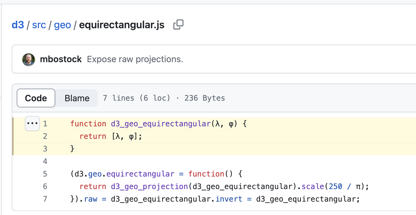
If you need cross-linguistic symbols for an equation, use the Greek letters (either the θ = latitude, φ = longitude convention or the θ = longitude, φ = latitude convention).
Personally, I find it clearest to just abbreviate them, so l = longitude and l = latitude.
At its core, doing anything with geodetics is basically (1) very straightforward math that you can derive in your head from the Wikipedia illustration of trigonometric functions, plus (2) several hours of figuring out what φ means in this case and which definition of “up” the author is assuming.


@vruba and whether or not longitude is positive west

@vruba "What's up with geodetics?"

@vruba And coordinate transformations between various rectangles.

@vruba Did you know latitude is a contraction of "later it is dude"?
@sgillies I always confuse it with latigator.
@vruba Why not just follow the convention of always putting the smaller number first?
@kgjenkins This approach has much to recommend it. You could also save space by adding them.
@vruba Always be sure to alphabetize your what-three-words, or simply rearrange them into an anagram.

@kgjenkins @vruba The German Was3Wörter turned out out to be less efficient, requiring 1MB per location 🦧
@djh @kgjenkins It keeps trying to compound them into dieses1wort.

@kgjenkins @vruba I see the puns, but this is actually the convention, on purpose, for the Dutch projection/grid: EPSG:28992, in meters, 0,0 x,y near Paris. Within The Netherlands y > x, always, so you never can go wrong...

@vruba “Personally…” that made me smile, tyvm.

@vruba Thank you for putting it so plainly.
I'm trying to adapt from MGRS now that I'm a civilian, but fuck me it's like trying to from Metric to Imperial

@vruba it really is easy, if you use the latlon convention, then you can map lat to x and lon to y… wait…

@vruba first-class geog shitposting 🙏😄

@vruba 🙂 just in case https://macwright.com/lonlat/ by @tmcw


@nelson definitely caused some problems, a lot of folks didn't specify a charset and that caused it to blow up: https://github.com/d3/d3/issues/1710 - they were eventually replaced https://github.com/d3/d3-geo/issues/8

Lest anyone think I’m making up the Greek letters.
And to be fair, sometimes you also see λ. That’s great because λ is equivalent to l, so it stands for the one of longitude and latitude that starts with l.