
A new paper about cities 🏙️, their structure 🧩 and satellites 🛰️!
"Decoding (urban) form and function using spatially explicit deep learning" by me and @darribas
https://doi.org/10.1016/j.compenvurbsys.2024.102147
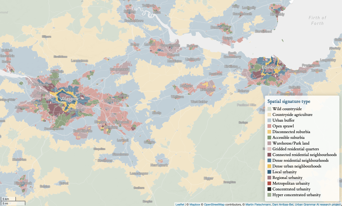
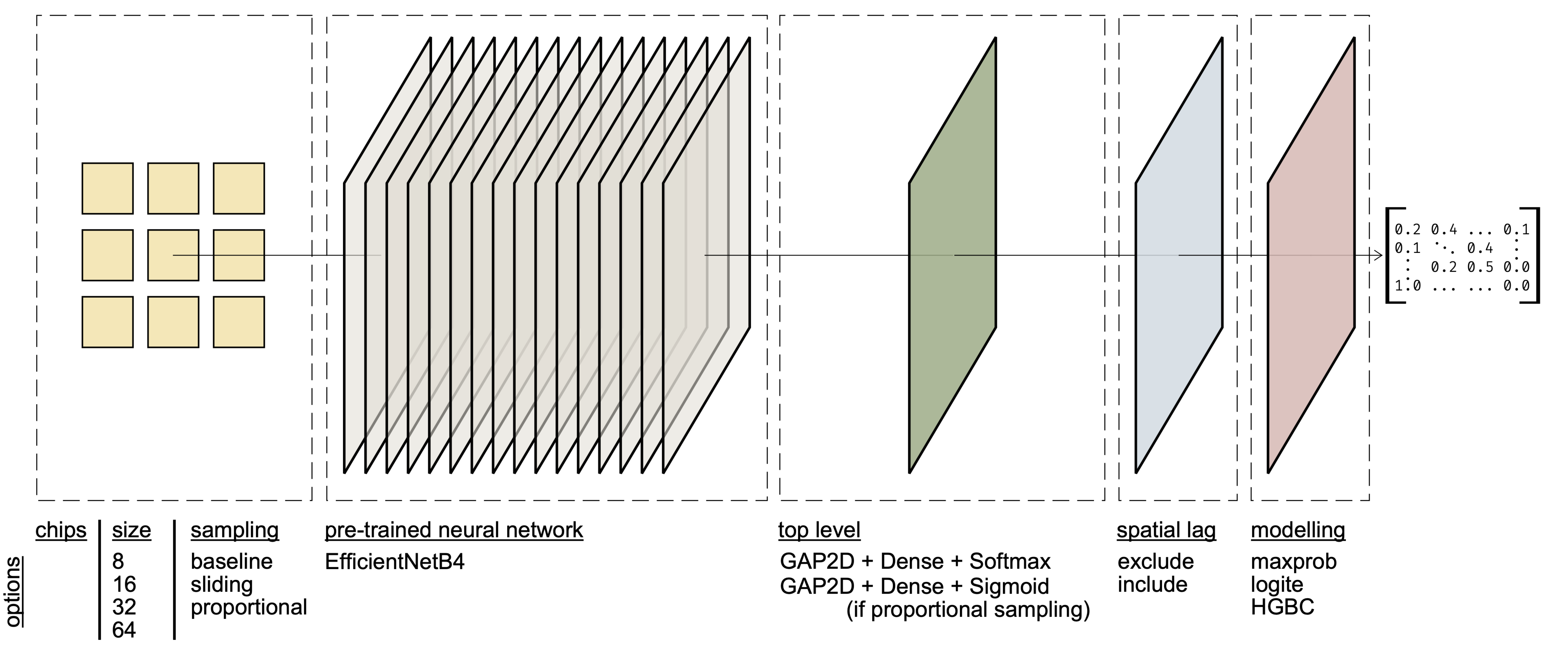
We took spatial signatures and built a neural network to pick them up from Sentinel 2. And since it didn't show great results, we mixed in some geographic data science to learn if and how much it helps.
A quick 🧵 on work that took us 3 years to finish 🙃.
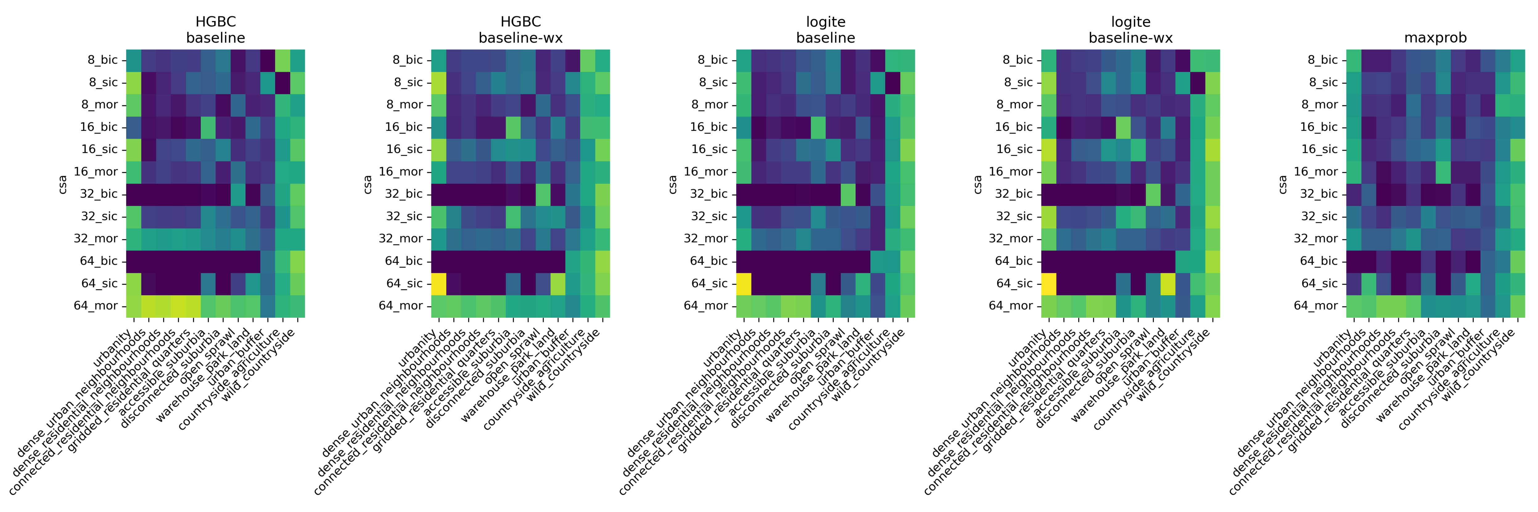
The inclusion of spatial modelling 'on top' of the predictions from the CNN proved to consistently improve the performance of the modelling pipeline, while some other techniques showed occasional success.
In the end, we managed to improve the accuracy of the prediction by almost 0.2 in some cases, bringing the quality of the tricky signature prediction up to the level of common land use or land cover prediction models.
The link to the open access paper is in the first post. The code is available at https://urbangrammarai.xyz/signature_ai/ and the intermediate data at https://doi.org/10.6084/m9.figshare.26203367.

@martinfleis Following up: I lean on your concept in https://github.com/celoyd/potato/blob/main/docs/concepts.md and https://github.com/celoyd/potato/blob/main/docs/personal.md
