
Charlie Loyd @vruba@everything.happens.horse
- charlie@planet.parts
- work
- geographical pixels
- where
- Xučyun/Oakland, Ohlone land, western Laurentian accretions
- who
- him
You know him on the internet. Eucalypt-adjacent; very occasional writer. Consulting and passively looking for work in geospatial, image processing, and related fields.
Joined Apr 2022
The kids on TikTok are obsessed with this new trend called the Don’t Uncritically Platform Dangerous Transphobia in a Paper of Record and Deflect Valid Criticism Like a Coward challenge and you’ll never believe the dance that goes with it!
Charlie Loyd
boosted

Charlie Loyd
boosted

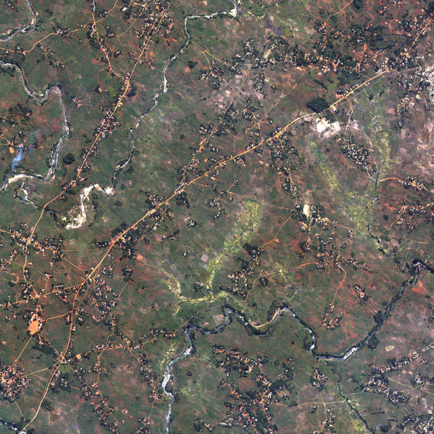
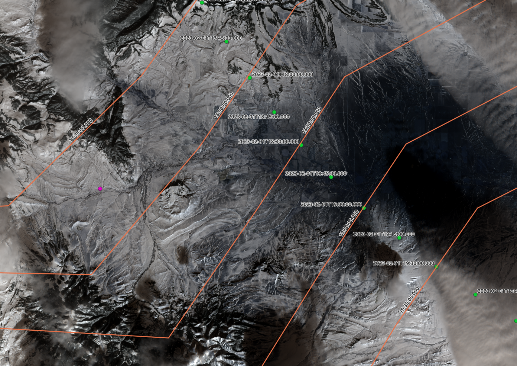
Alright, I think this is an actual image of The Balloon on Feb 1 via Sentinel 2B.
The tile is T12TWS @ 2023-02-01 18:15z (I used the L1C product)
Coordinates are -110.473 46.429.
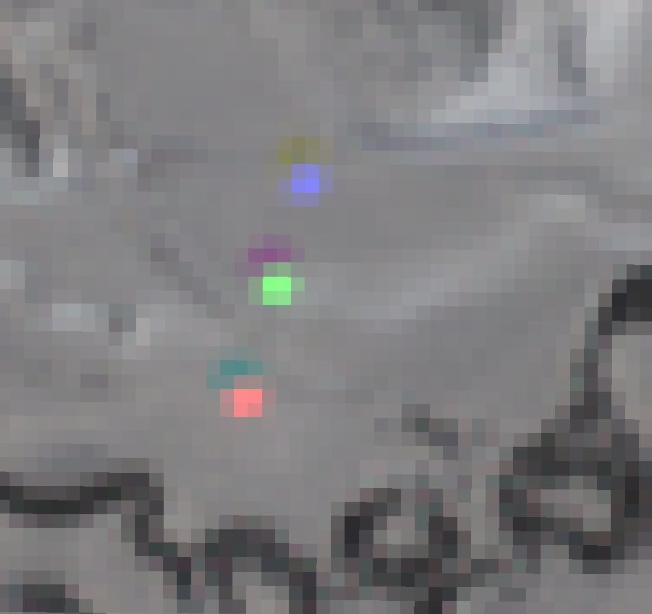
In image 3 the probable balloon is the pink dot, the green is my best fit trajectory from Billings to the shoot down. The orange lines are equal time lines for varying starting altitudes in Billings.
I checked against fr24 and adsbexchange and nothing really close on there.
GNSS stuff
Last I played with consumer GNSS hardware much, the SiRFstarIII was considered very cool.
I just ran a new NEO-N9M overnight under a residential roof (no survey mode or anything) and got this wonderfully clean pattern.
All units are meters. I don’t know what pAcc actually is and neither does the official documentation.
This is like $50 for a USB-capable board with shipping and tax from a reputable seller. I’m delighted.
There’s what I would describe, in technical terms, as a “lazy fantasy map” vibe to the distribution of NGS survey markers.
@ingrid Tom Hardy giving the newbie an up-and-down look and saying “If you’re looking for a place to start, try ‘Ground Truth: The Social Implications of Geographic Information Systems’. Edited by John Pickles. ’94 or ’95.”
@paulmison Anyway, for the word count and the presumed audience, I think this is a spectacularly good piece and will be recommending it.
@paulmison Specifically, I think it’s super relevant to point out that lossy compression is often used as a backbone for lossless compression (predictor + residual models). That tells us something about all these issues. But I also see why that would be one of the first paragraphs you’d cut for space and focus.
@paulmison I think focusing on compression is very good (it’s how I tend to think about this stuff) but the exact phrasing of why people don’t use LLMs on the Hutter Prize is basically wrong as stated. Probably down to editorial brevity decisions, not misunderstanding, though.
@paulmison For example, I think the no-output-as-input argument is correct but not as airtight as it might seem to a lay reader – one could argue that it’s more just a redundancy thing.
I have quibbles with this but they’re “why didn’t you mention this important detail” kinds of things. I think it’s admirably clear and fundamentally right-headed. https://www.newyorker.com/tech/annals-of-technology/chatgpt-is-a-blurry-jpeg-of-the-web
smarmy, painfully literal posters who seem to be typing out unconsidered impressions of the world ← [the infinitesimally small but infinitely correct space that I occupy] → internet-poisoned edgelords nine layers of irony away from their own feelings
@kissane Whereas I’m kind of embarrassed by how much fun the image generators are for me.
Also, as a third category, doing little projects in domains that interest me on my home workstation has been one of my most fulfilling pandemic hobbies. It’s given me a bunch of new metaphors and produced nothing Useful, so, huge success.
@kissane Hard same. There are things I want to try one day with text tools, but the chatbots in the news leave me cold at best.
@kissane I agree, and I also think there’s a useful implication that comes right out of this: that it’s generally more useful the less we try to force it into the (“the”) human image.
Fissures across a railway and someone’s orchard just north of İslâhiye.
Türkiye is standard gauge, so that’s basically two offsets of ~70 cm just in this little area. (Pan pixels from Maxar 1040010082698700 at 31 cm resolution; the image is about 320 m or 1000 ft across.)
This is not the part of the image with the rawest human interest, but I think it shows some of the scale of what happened without feeding into voyeurism.
The serving sizes on the labels are pretty unrealistic in my experience.
- charlie@planet.parts
- work
- geographical pixels
- where
- Xučyun/Oakland, Ohlone land, western Laurentian accretions
- who
- him
You know him on the internet. Eucalypt-adjacent; very occasional writer. Consulting and passively looking for work in geospatial, image processing, and related fields.
Joined Apr 2022
